Drone Photography That Sells Homes
Aerial photography has changed the way buyers experience real estate online.
A decade ago, drone images were something you might expect to see primarily on luxury estates, waterfront properties, or large commercial listings. Today, drone photography has become one of the most useful tools a real estate agent can have—especially when marketing homes in The Villages, Florida.
But there is an important distinction.
Good drone photography is not about seeing how high you can fly. It is about showing buyers something they cannot understand from the ground.
A beautiful aerial photograph can reveal a home's relationship to a golf course, pond, preserve, cul-de-sac, neighborhood entrance, or surrounding community. It can show the size and shape of the lot, highlight outdoor living spaces, and create the kind of opening image that makes someone stop scrolling.
Used correctly, drone photography does more than make a listing look impressive.
It helps tell the property's story.
Buyers Aren't Just Buying the House
When buyers begin looking at homes online, they naturally focus on bedrooms, kitchens, bathrooms, and living spaces.
But eventually another question becomes just as important:
Where is the house?
That question is especially significant in The Villages.
Two homes with similar floor plans can feel completely different depending on their location.
One might sit on an interior lot surrounded by neighboring homes.
Another might overlook a golf course.
Another could have a pond behind the lanai.
Another may be positioned on a corner lot with additional visual space.
And another may have a backyard that opens toward mature landscaping instead of directly toward another residence.
Traditional ground-level photographs often cannot communicate those differences effectively.
Drone photography can.
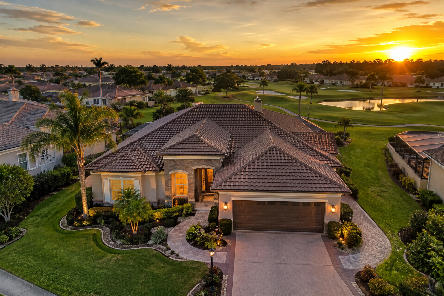
Beautiful Florida home in The Villages photographed from a low aerial angle during golden hour, showing the home, landscaping, neighborhood, and surrounding environment.
The Best Drone Images Aren't Necessarily the Highest
One of the biggest misconceptions about drone photography is that higher equals better.
It usually doesn't.
If I take a drone hundreds of feet into the air and photograph a house, eventually that house becomes a tiny rectangle surrounded by hundreds of other rooftops.
That's interesting.
But it may not sell the property.
For real estate marketing, some of the strongest aerial photographs are taken from relatively low angles.
At the right height, we can still clearly see the front elevation of the home while also revealing the roofline, landscaping, lot placement, neighboring properties, and surroundings.
That gives the photograph dimension.
Instead of simply looking at the front of a house, the buyer begins to understand how the property fits into its environment.
That is the goal.
Every photograph should answer a question for the buyer.
Aerial photographs are no different.
Drone Photography Shows What Ground Photography Cannot
Imagine a home sitting directly on a golf course.
From inside the home, we can photograph the view through the windows.
From the lanai, we can show the fairway.
From the backyard, we may be able to show some of the surrounding landscape.
But none of those photographs completely explain the property's location.
Now move the camera into the air behind the home.
Suddenly the buyer can see the house, lanai, backyard, golf course, surrounding landscaping, and perhaps even the fairway stretching into the distance.
One photograph tells the entire story.
The same thing happens with waterfront or pond views.
A ground-level photograph may show water behind the house, but an aerial perspective can show how much shoreline the property has, where the home sits relative to the water, and how open the view really is.
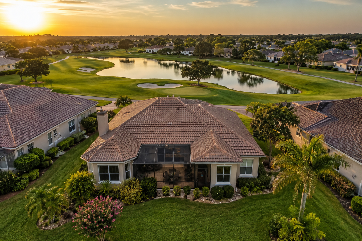
Professionally photographed aerial view of a home in The Villages backing onto a golf course or pond, photographed from a lower drone angle that clearly shows both the property and the view.
That context matters.
Especially when the location is one of the home's strongest selling features.
Drone Photography Can Create a Powerful First Impression
Real estate marketing starts long before someone schedules a showing.
It starts with a thumbnail.
A buyer may be scrolling through dozens of properties on a real estate website, phone, tablet, or social media feed.
One listing after another begins to look similar.
Roof.
Driveway.
Garage.
Front door.
Next house.
Next house.
Next house.
Then suddenly there is an image showing a beautifully landscaped Florida home from an elevated angle with warm evening light, palm trees, a golf course behind it, and an attractive neighborhood surrounding it.
That image creates a pause.
And getting someone to pause is valuable.
The purpose isn't to trick someone into clicking the listing.
The purpose is to give them a reason to become curious.
A strong opening photograph says:
There may be something special about this property. Take a closer look. Show the Lot, Not Just the Roof
There is a type of drone photograph I see frequently in real estate marketing that I don't particularly like.
The camera flies almost directly above the house and points straight down.
You get a beautiful picture of…
The roof.
There are situations where a top-down image is useful, particularly when showing lot boundaries, property layout, acreage, waterfront relationships, or unusual property configurations.
But for most residential listings, it shouldn't be the only aerial perspective.
Buyers aren't purchasing roofing shingles.
They are purchasing a home and the lifestyle around it.
A better drone sequence usually combines angles.
A lower front aerial photograph establishes the property.
A rear angle shows the backyard or view.
A slightly higher image provides neighborhood context.
And, when appropriate, a true overhead photograph can explain the lot.
Together, those photographs help the buyer understand the property in a way that ground photography alone cannot accomplish.
Aerial Photography Is Especially Valuable in The Villages
Real estate photography should always reflect what matters in the local market.
In The Villages, outdoor living and location can be enormously important parts of the buying decision.
Golf courses.
Ponds.
Lanais.
Pools.
Mature landscaping.
Open spaces.
Neighborhood streets.
Recreation areas.
These aren't simply background elements. They can be part of the lifestyle a buyer is considering.
A well-composed aerial photograph can visually connect the house with those surroundings.
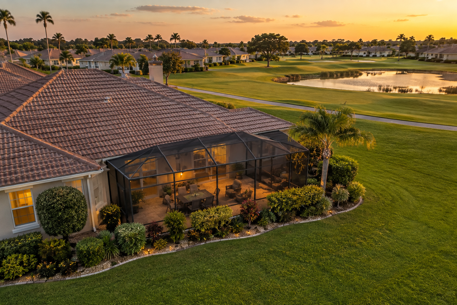
Low-angle aerial photograph showing a Florida home's screened lanai, backyard, landscaping, and golf-course or open-space setting.
Consider a home with a beautiful screened lanai overlooking an open area.
From the ground, we photograph the lanai beautifully.
But when the drone rises slightly above the property, buyers can see why that lanai is special.
Now they understand what they'll be looking at while sitting outside with their morning coffee.
That emotional connection is difficult to communicate through MLS remarks alone.
Photography lets buyers see it.
Location Images Need to Be Honest
Drone photography is powerful, which means it also needs to be used responsibly.
An aerial photograph can make something look much closer than it actually is.
For example, a community feature several miles away might appear visually close when photographed with certain lenses, angles, or compositions.
That may create an impressive picture, but it can also create unrealistic expectations.
My preference is to use aerial photography to clarify a property's location rather than exaggerate it.
If a home is genuinely close to an important feature, we can show that relationship.
If an amenity is farther away, the photography should communicate that honestly.
The objective isn't simply to create the most dramatic image possible.
It's to create an attractive and accurate representation of the property.
That philosophy applies to every part of professional real estate photography.
Bright doesn't have to mean fake.
Wide doesn't have to mean distorted.
And aerial doesn't have to mean exaggerated.
Drone Photography Can Add Value to More Than Luxury Listings
Another misconception is that drone photography only makes sense for expensive homes.
I don't think that's true.
The question shouldn't be:
"Is this house expensive enough for drone photography?"
The better question is:
"Does seeing this property from the air help the buyer understand it?"
A modest home with a beautiful golf-course location may benefit enormously from drone photography.
So might a home on an oversized lot.
Or a corner lot.
Or a property with an attractive pool and lanai.
Or a home with an unusually private backyard.
Meanwhile, a much more expensive home tightly surrounded by neighboring houses may gain less from aerial coverage.
The value depends on the property—not simply the listing price.
Drone Photography and Video Work Even Better Together
Still photographs aren't the only way to use a drone.
Aerial video can create an entirely different experience.
Instead of simply seeing a property from above, buyers can experience a smooth approach toward the home, move around the property, reveal the backyard, and transition into the surrounding landscape.
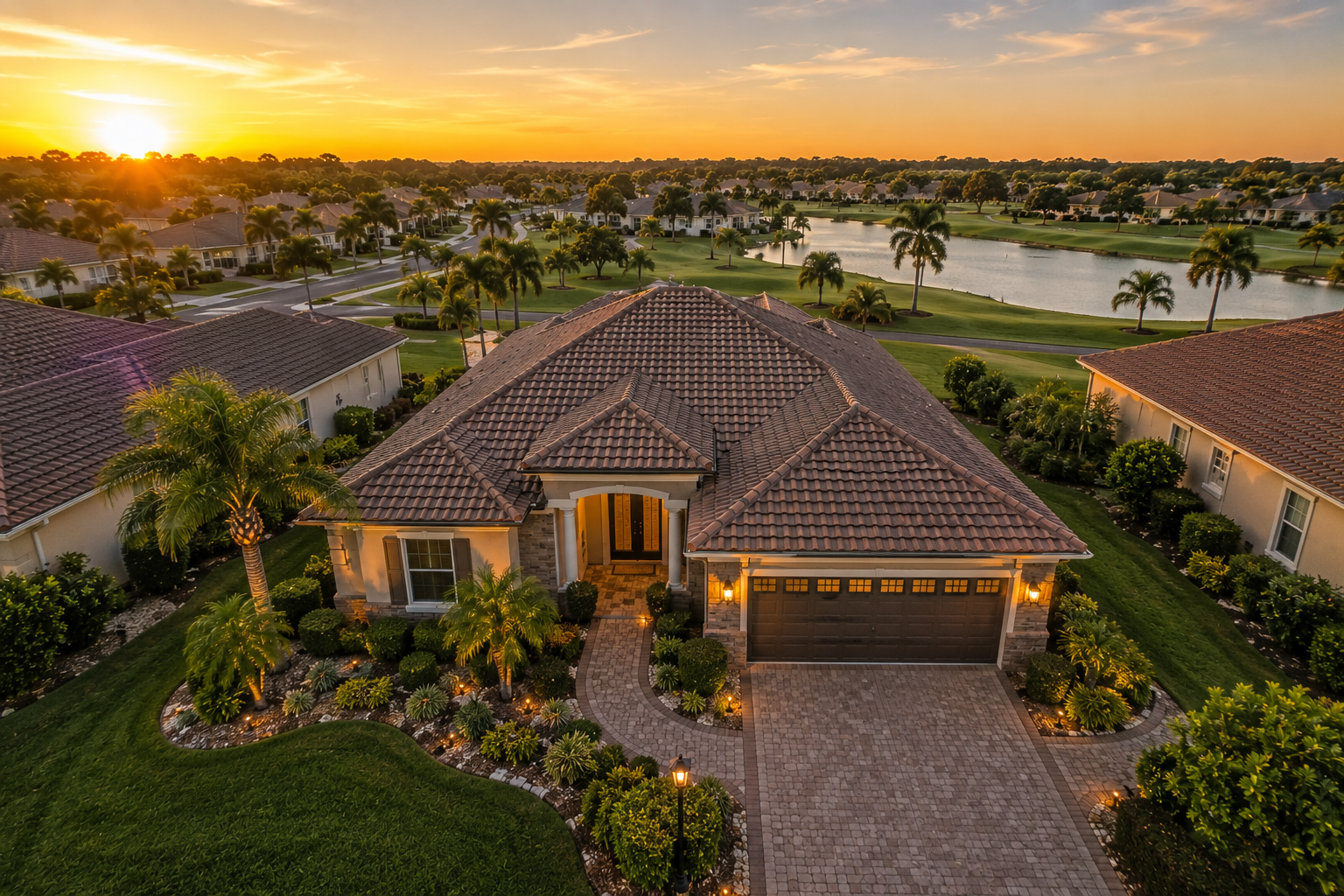
Cinematic aerial perspective approaching an attractive home in The Villages during golden hour with landscaping, roofline, and neighborhood visible.
Used carefully, those movements help establish a sense of place.
And that makes aerial footage particularly useful for social media, property videos, agent branding, and higher-end marketing packages.
But just like still photography, movement needs a purpose.
Constant spinning, diving, flying and dramatic transitions may show what the drone can do.
They don't necessarily show what the property offers.
The best real estate video movements often feel almost invisible.
They are smooth enough that the buyer focuses on the house instead of the camera.
Professional Drone Photography Also Means Flying Legally
Commercial drone photography isn't simply a matter of purchasing a drone and launching it over a listing.
In the United States, business drone operations generally fall under the FAA's Part 107 rules. The person operating the controls must hold an FAA Remote Pilot Certificate or operate under the direct supervision of someone who does. Depending on the location, controlled airspace may also require authorization.
FAA requirements also include Remote ID rules for drones that are required to be registered, subject to applicable exceptions.
For agents and homeowners, that matters.
Hiring a professional real estate photographer for drone work shouldn't only mean receiving attractive pictures. It should also mean working with someone who understands airspace, flight restrictions, safety, weather, surrounding people and property, and the responsibilities that come with commercial drone operations.
Sometimes the professional decision is to fly.
Sometimes the professional decision is not to fly.
Safety and legality always come first.
Not Every Property Needs a Drone
This may sound strange coming from someone who offers drone photography, but I believe it is important:
Not every listing benefits from aerial photography.
If the aerial photographs don't reveal anything useful, including them simply because a drone was available doesn't improve the listing.
Good real estate marketing is about choosing the right tools for the property.
Sometimes the most important photograph is a beautifully lit kitchen.
Sometimes it's a dramatic twilight exterior.
Sometimes it's the lanai.
And sometimes it's that aerial photograph showing a home perfectly positioned beside a golf course.
The photographer's job is to recognize the difference.
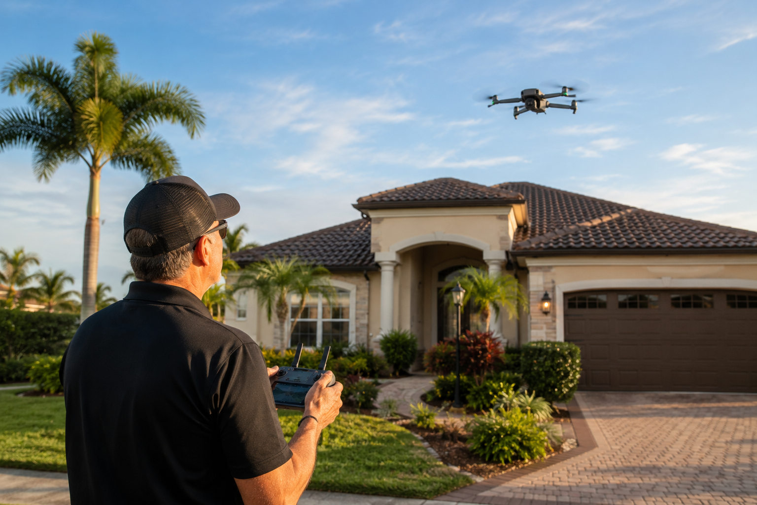
Professional real estate photographer safely operating a drone outside an attractive Florida home, with the drone visible in the sky and the property in the background. Natural documentary style
The Drone Is Only a Tool
There is something important I tell people about cameras, lenses, drones, lighting equipment, and editing software.
None of them create great real estate marketing by themselves.
You can purchase an expensive camera and still take poor photographs.
You can purchase a sophisticated drone and still create aerial images that don't help sell a home.
The equipment matters.
But knowing what to photograph, when to photograph it, where to position the camera, and why the image belongs in the listing matters more.
When I photograph a property from the air, I'm not simply looking for a pretty angle.
I'm asking questions.
What is special about this lot?
What can I show from the air that buyers cannot see from the ground?
Is there a view worth emphasizing?
Does the aerial image make the home easier to understand?
Could this photograph become the hero image that makes someone stop scrolling?
Those decisions turn drone photography into real estate marketing.
You're Selling Perspective
One of the greatest advantages of professional real estate photography is that it gives buyers perspective before they ever step through the front door.
Interior photography helps them understand the rooms.
HDR photography helps them see bright interiors while maintaining important exterior views.
Detail photographs help communicate finishes and craftsmanship.
And drone photography helps answer one of the biggest questions of all:
Where does this home fit into the world around it?
For properties in The Villages, that can be an incredibly valuable question to answer.
A home isn't simply four walls and a roof.
It is the lanai overlooking the fairway.
It is the pond beyond the backyard.
It is the landscaping around the property.
It is the privacy—or openness—of the lot.
It is the neighborhood surrounding the home.
It is the feeling someone gets when they begin imagining themselves living there.
The drone allows us to move the camera high enough to reveal those relationships.
But the goal isn't altitude.
The goal is understanding.
And when the photography helps a buyer understand why a property is special, that's when drone photography starts helping sell the home.
Coming Next:
Great real estate marketing doesn't come from one spectacular photograph. It comes from combining the right photographs, perspectives, techniques, and presentation into one consistent visual story.
In the next chapter, we'll continue building that story and look at another part of professional real estate marketing that can transform the way buyers experience a listing online.
About the Author
Scott Ledbetter is a professional real estate photographer and the owner of S & R Real Estate Photography, serving Realtors, homeowners, and real estate professionals throughout The Villages and surrounding Central Florida communities.
S & R Real Estate Photography provides professional real estate photography, HDR photography, drone photography, Matterport 3D tours, Zillow Showcase services, video, and other visual marketing solutions designed to help properties stand out in an increasingly competitive online marketplace.
Scott's approach is simple: real estate photography should be bright, natural, accurate, and designed to help buyers understand what makes a property special.
S & R Real Estate Photography
The Villages, Florida and surrounding communities
407-616-7510